This post is to focus on cycling adventures: if you want to know some background about the island, read my other post!
I took the map from my hostel to be a challenge to see as many moai (statues) as I could. Being nervous of colliding with one of the many wild horses on the island if I was in a car or on a motorbike, I hired a mountain bike (there are plenty of places in Hanga Roa). The majority of the roads are unpaved so make sure you have good tyres on your bike!
Easter Island is a triangular island around 23km long, formed by a volcano at each point of the triangle: Rano Kau with Orongo village, Teravaka (the highest point of the island, 507m) and Poike/Puakatike. I had two days: I decided the first would be a counter-clockwise route around the south-east to the north-east of the island, including the quarry site of Rano Raraku volcano and probably the most famous ahu (platform) at Tongariki. The second day would be a trip to the area north of Hanga Roa: to the highest point of the island, the red topknot quarry and hidden caves.
I was somewhat ambitious about the ground I could cover: it takes longer than you think because of the roads, the heat and time spent finding moai! Some of the sites are marked with handy wooden signs, some have explanation boards, some have nothing marking the spot: just stare at the rocks and find faces staring back! Remember not to touch or step on any monument: they are protected, sacred spots.
Day One: The Classic Sights of Vinapu, Rano Raraku and Tongariki
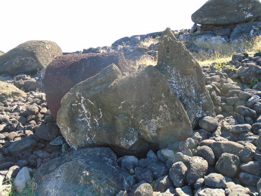
My first stop was Vinapu, past the island’s old fuel depot around the edge of the airport’s fenced runway. The site has two destroyed ahu and a totally red-stone moai. It’s a lovely deserted site to get closer to the ahu and appreciate how they were completely thrown down. I cycled further up the coast, and explored the eight overturned moai at Ahu Hanga Te’e (Vaihu).
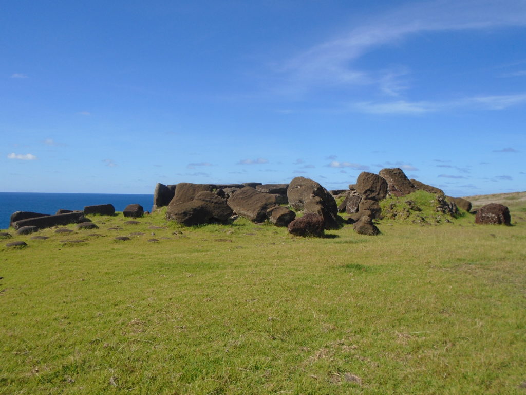
Vinapu: ahu with toppled moai 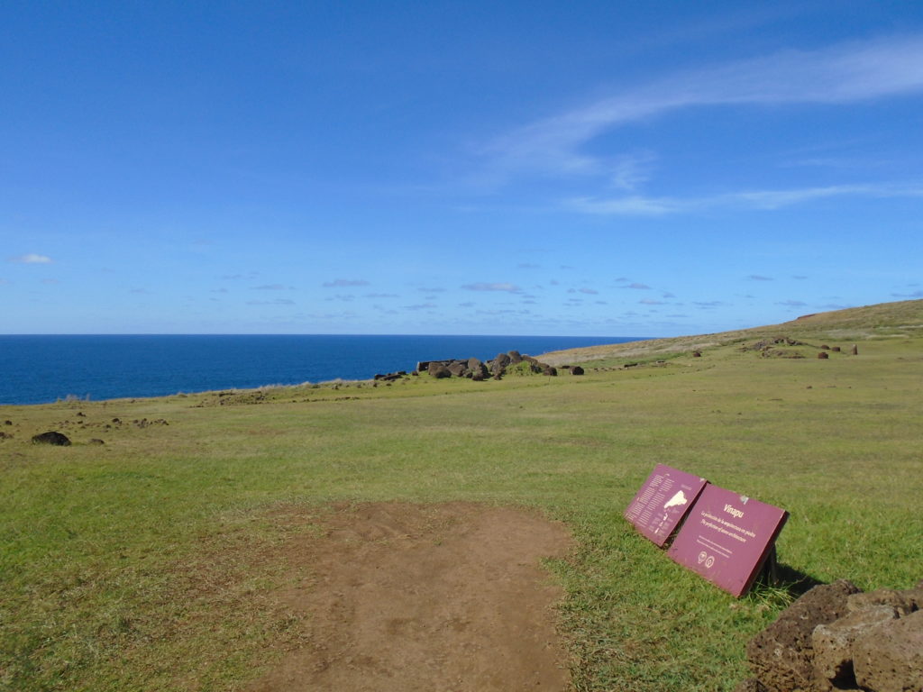
Sometimes there are signs!
I was most touched by the rough trail I followed from the coast to Rano Raraku (marked on my map and Maps.me). I cycled by so many abandoned statues unloved face-down in the dirt. The dirt trail was one of the ways used to transport the moai from the quarry and obviously many had been left where they fell. Their only protection were some logs passed haphazardly over them as they lie uncared for and unseen.
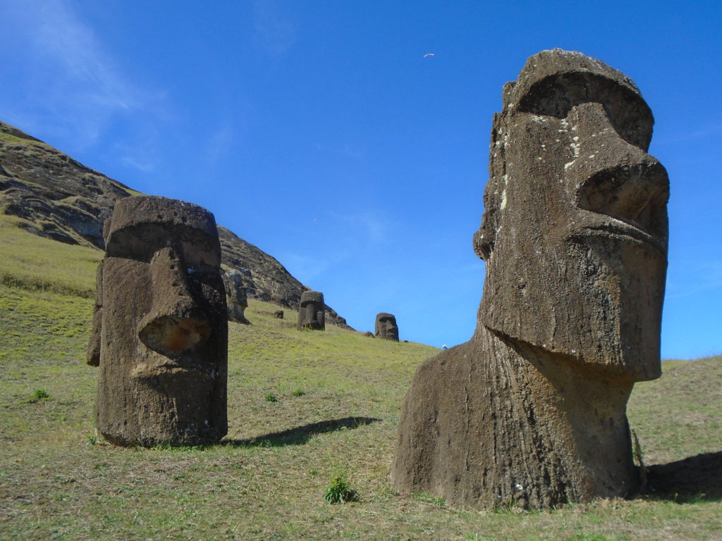
Ranu Raraku is that picture in your mind of Easter Island, a hillside sprouting stone heads. All the heads hide completed bodies beneath, buried when the earth ramps further up the quarry collapsed and swamped them. There are unfinished moai carved into the rocks. My eyes started to play tricks as I stared at the rocks and saw faces everywhere. Here is also a moai carved with a European ship and a solitary kneeling moai, carved by some maverick breaking with tradition. I’m afraid that I didn’t explore all the way to the crater (turn left when you enter the site) because of the heat and time ticking on.
Kneeling moai Rano Raraku with Ahu Tongariki behind 
Biggest moai in situ in quarry (lying down to right)
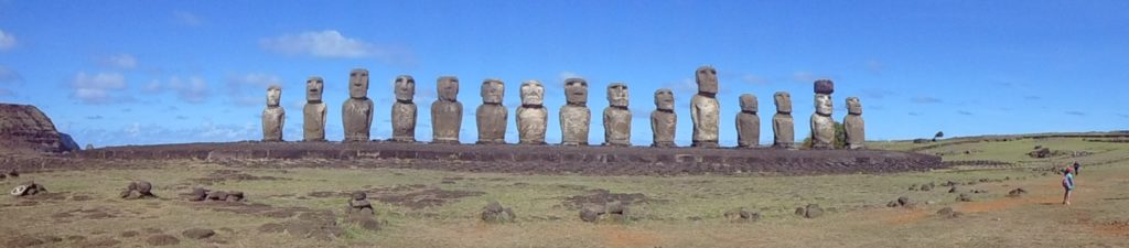
Ahu Tongariki, with 15 moai, was restored by Chile with Japanese funding and is the classic ahu featured in many, many pictures. It’s the island’s prime spot for sunrise pictures. There’s a handy dirt mound where you can stand in line with the moai for a picture. Despite a warden and stones guarding the ahu, horses and sheep wandered grazing about the rocks.
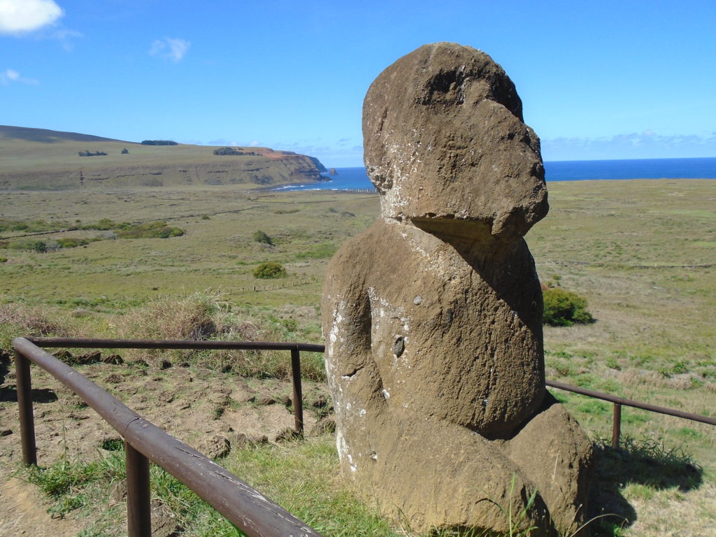
I continued cycling around the base of Poike hill to the Papa Vaka rock carvings, hunting fish hooks and marine animals in the rock. Te Pito Kura is where a giant 10m high moai called Paro stood, the last to be seen upright. I couldn’t find The Navel of the World (a stone said to be brought by the island’s first king from their homeland) and decided that was the end of adventures for the day. I cycled the main road from Anakena Beach back to town. I was exhaused; the apples from a roadside stall never tasted so good.
I cycled to Anakena Beach on another day for relaxation. It’s here that the first Polynesian explorers drew up their canoes on the island and they couldn’t have chosen a more beautiful place. The palm trees may be imported from Tahiti but they fit in perfectly here with the white sand and the huge Ahu Nau Nau. There’s an old moai head repurposed as part of the ahu and the moai themselves are covered in intricate tattoos, better preserved than others on the island because they had been covered by the sand. The single moai is Ahu Ature Huki, the first to be restored on the island. There’s a couple of bars and restaurants at the beach so go on, treat yourself after all that cycling and relax here for a day.

Day Two: Hidden Places of Mountains and Caves
First stop just on the outskirts of Hanga Roa was Puna Pau, the redstone quarry for the pukao (topknots). They still litter the floor here but my enjoyment was hampered by busloads of people who arrived. I quickly headed on up the road to Aku Akivi. This is a lovely ahu of seven moai, said to be represent the seven original settlers of the island (but this story was probably a later invention). It’s the only inland ahu, is orientated to the Spring Equinox and looks beautiful against the hillside.
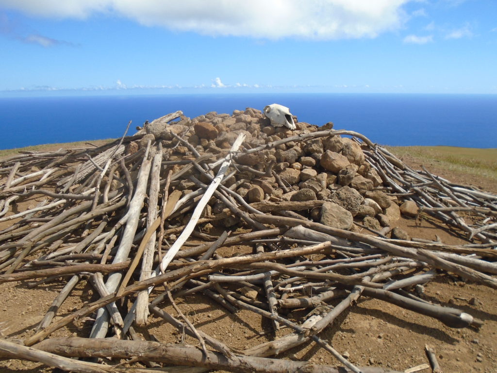
Just before the ahu is the trail leading to Terevaka, the highest point on the island. I climbed with the bike upwards and followed an obvious line towards the summit (511m? 508m? 507m? Who knows). The summit is marked by a pile of sticks, a cow’s skull and an incredible view of the whole island. The whole world if you were a Rapa Nui. The inhabitants here thought they were the last people in the world; much more disturbing than thinking you are the only ones. Imagine being the last people on earth, resources diminishing, the gods failing and anarchy unfolding- with no way of escaping…
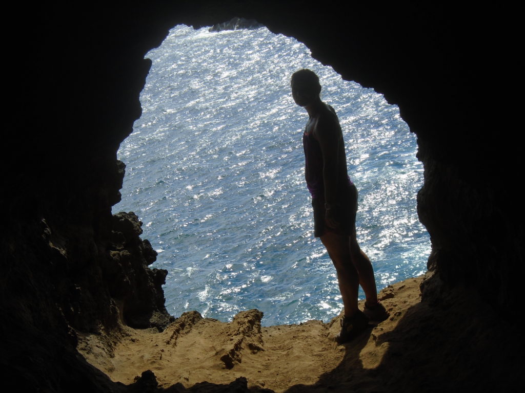
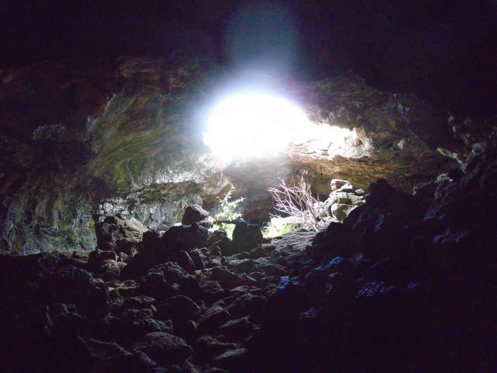
Following those cheerful thoughts, I went off tarmac on a very exciting path to a series of caves. The caves on the island are lava tubes: formed by lava flowing underground to the sea. The first cave Ana Te Pahu was amazing, a long perfect tunnel going so far that I was afraid to explore to the end even with my head torch. If I had known then there were no bats or snakes on the island, I may have gone further. I cycled on to make it to the wilder, west coast of the island. There, I found the ruined ahu Ahu Te Peu with broken, undecipherable sign. I had to look at the stones, blink, look again… and then see it! I turned left to follow the coastline back to Hanga Roa, visiting more caves along the way. The first, Ana Te Pora, had a lovely cosy stone “bed” and a fun scrambling exit. The second is the well-known “Two Windows”/Ana Kakenga cave: you can stand in the perfect circular window looking out on white surf crashing below imaging the steam as hot lava met the waves.
I continued cycling down the coast back into town, passing Tahai including Ahu Ko Te Riku with his stunning white eyes, for a well-deserved beer by the sea.
TOP TIPS FOR CYCLING RAPA NUI/EASTER ISLAND
- Get a mountain bike: most roads are unsealed and broken, you will need the gears and the good tyres
- Carry lots of water and sunscreen: it is very hot with little shade
- Carry your own food: there’s not many opportunities to find provisions along the way. It is expensive on the island so best to bring some supplies with you to the island if you can
- Be prepared that you will not be able to go as far as you think: heat, poor roads, lack of signs and general excitement at the sites will slow you down
- Don’t attempt to cycle up to Orongo, it’s much easier to walk that gradient
- Get a little lost and enjoy yourself, that’s half the fun!
- Bring a head torch for the caves and don’t be afraid to explore them. They were an unexpected highlight of the island for me

One Reply to “How to Explore Rapa Nui/Easter Island by Bike”