Remote islands in the middle of the North Atlantic with lots of mountains, fluffy sheep and cool summer temperatures? Who could resist?
We landed into drizzle and clouds. The first drive brought to life the world I had imagined: white mist, green hills, stormy waters. The Faroese voices on the radio reminded me of the sound of Ulster Irish. The language is in fact a mixture of Viking Norse and Gaelic. Luckily we were able to pick up Irish radio on long-wave which was equally incomprehensible for George.
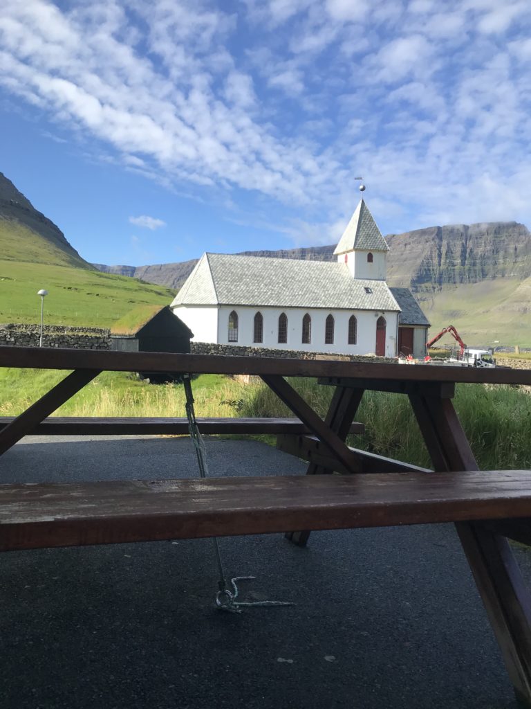
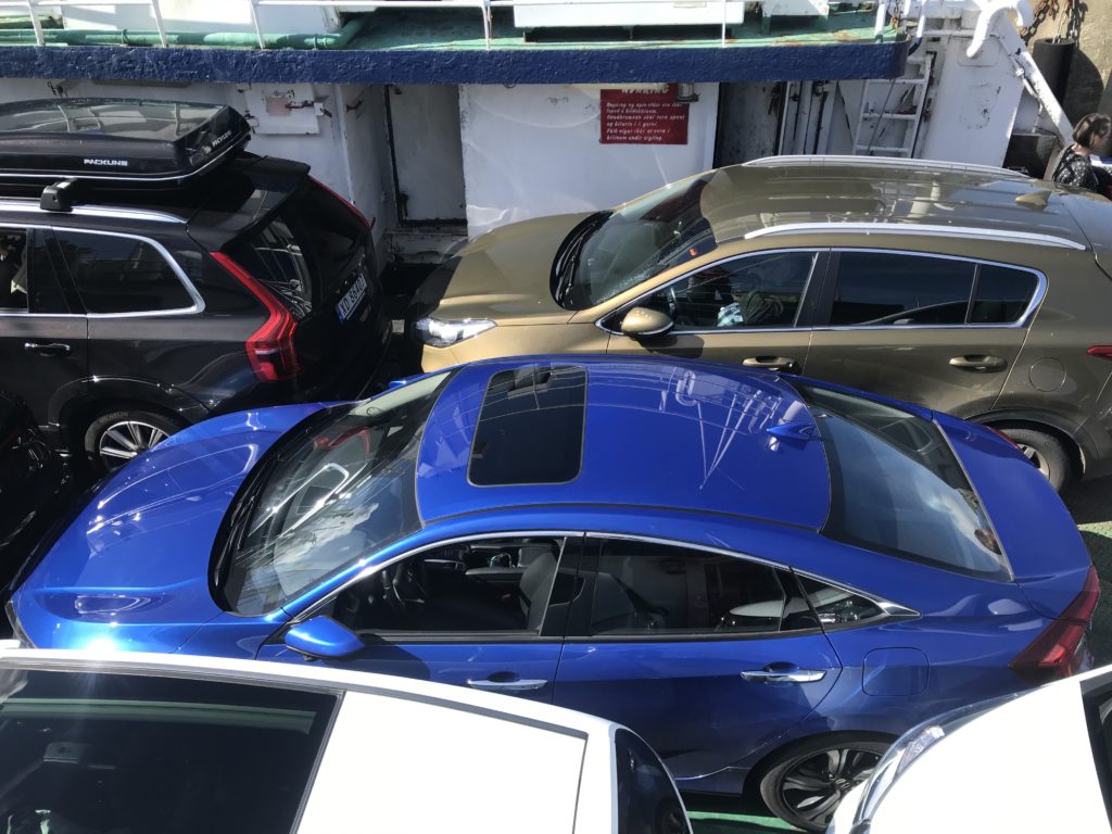
Logistics are always first. We bought camping gas and stocked up at a supermarket full of Danish delights (liquorice!). We drove to the ferry port in Tórshavn, parked in the queue for the ferry about two hours early and wandered off to explore town. We found Tinganes with its clustered red government buildings. I wondered if anyone could just pop in and see the prime minister as they wished, maybe report their neighbour for not going to church on Sunday…
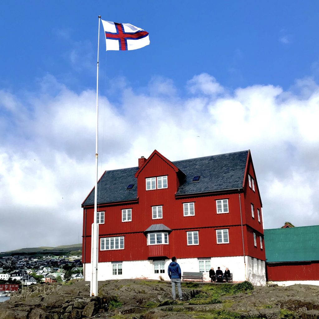
Tinganes, Tórshavn 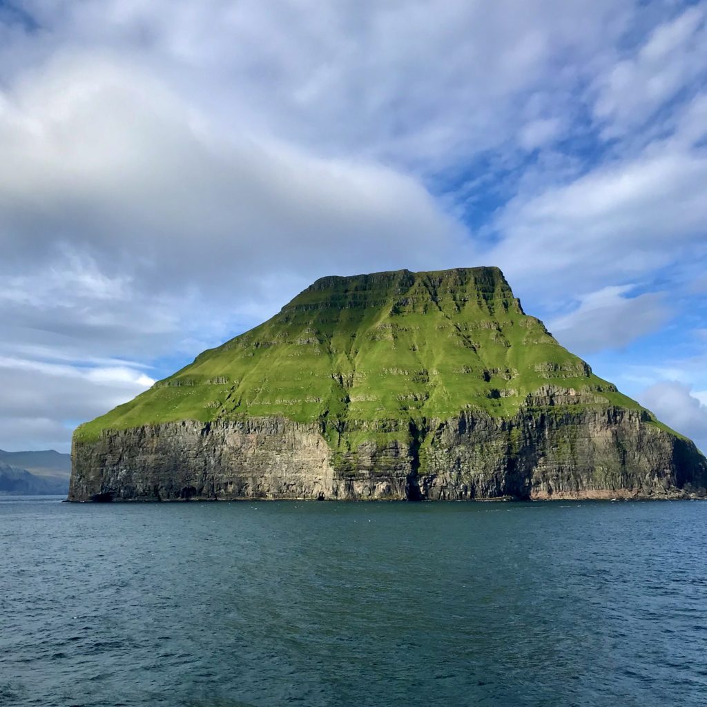
Uninhabited Lítla Dímun 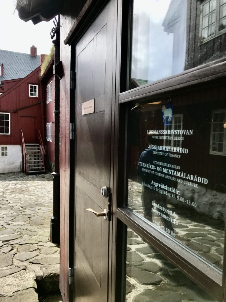
Prime Minister’s office
SUDUROY
I wanted to go to Suduroy, the southern-most of the 18 islands, because it is a little neglected by other visitors. The ferry there is a big, modern car-ferry that takes about two hours. You purchase the ticket for the whole trip on the journey back on the ship. I don’t remember anyone checking it though!
Despite some dire warnings, the crossing was smooth apart from a 15 minute section of larger waves near the end. The front of the ship is glass and the back has an open-air section so I enjoyed wonderful views of the islands as we passed. Ladies sat around us and knitted. Everyone on board visited the cafeteria: I guess it must do good value lunch. We had the buffet breakfast on the way back and it was a good price.
The one delight about the ferry port is that it’s right beside a Rusán, the government alcohol shop. We stocked up on Føroyar Bjór, the local beer brewed with Bavarian hops, and South African wine.
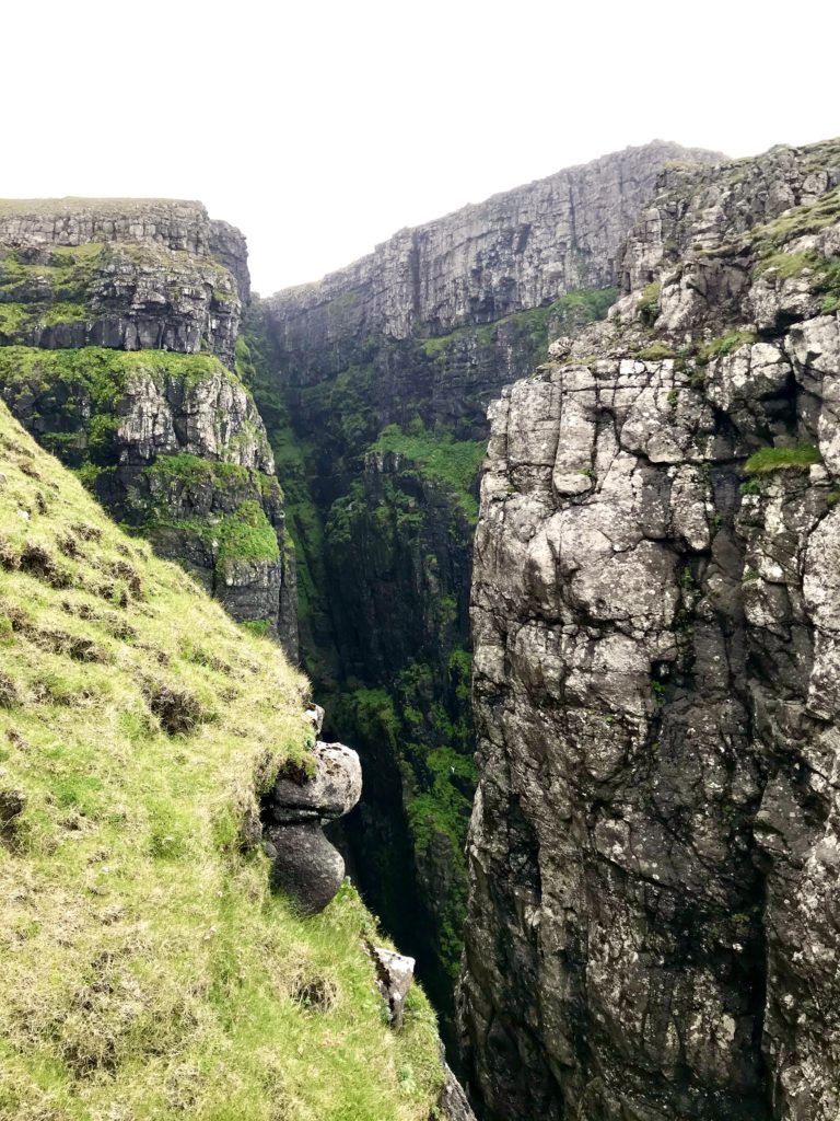
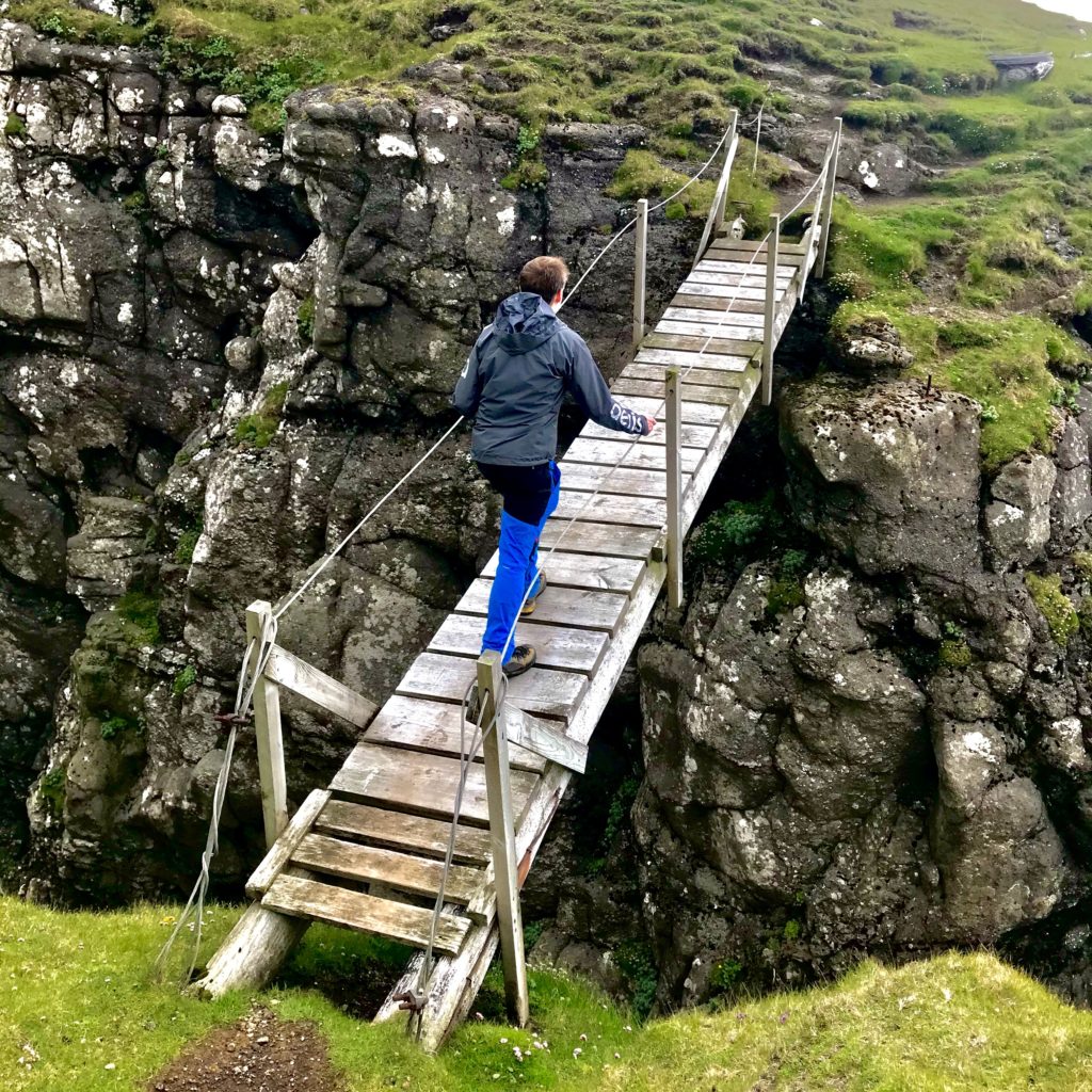
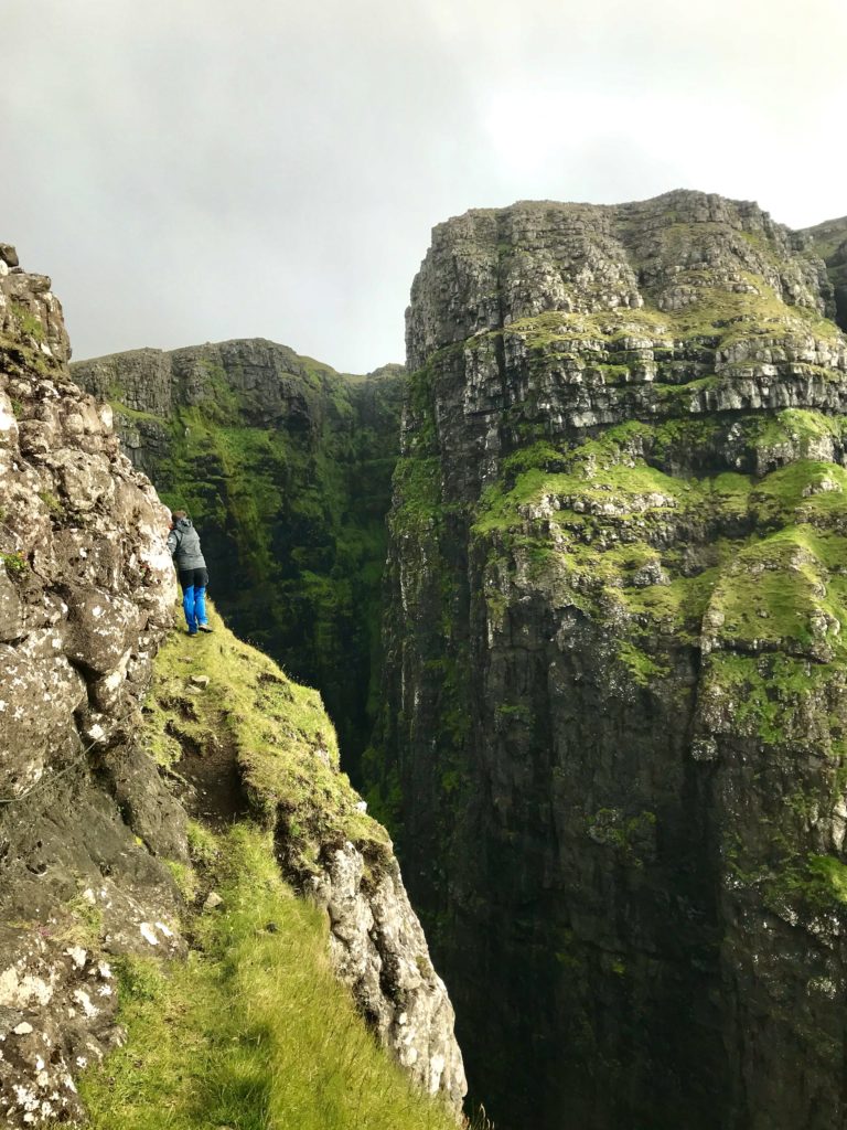
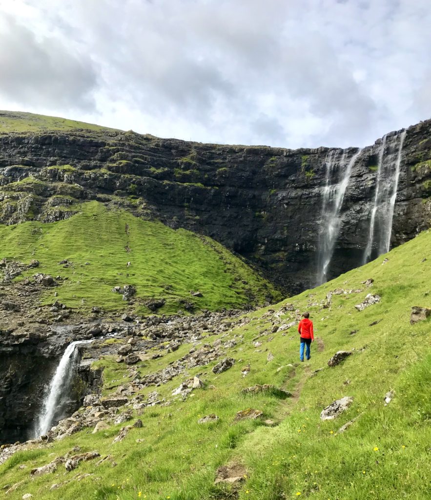
We explored the north of the island for a first taste of older tunnels. The tunnel between Trongisvágur and Hvalba is the oldest in the whole of the Faroes. Luckily, they appear to be building a new one. In the village of Sandvík, there is a road that runs north-west out of the village. It used to continue over the mountains to Hvalba and was the only access to Sandvík before a tunnel was built. We parked, walked up the road before spotting the guiding posts and wire leading up a slope. This led us to the most terrifying footbridge in the world. There is a huge gash into the land with a tiny little bridge over it. It’s hard to capture just how scary it is in a photo but it was enough for me. Not enough for George who went exploring down an old sheep path (there’s some particularly tasty sea-splashed grass they want). The views over Asmundarstakkur were wonderful and wild. What a first taste of the world we had arrived in.
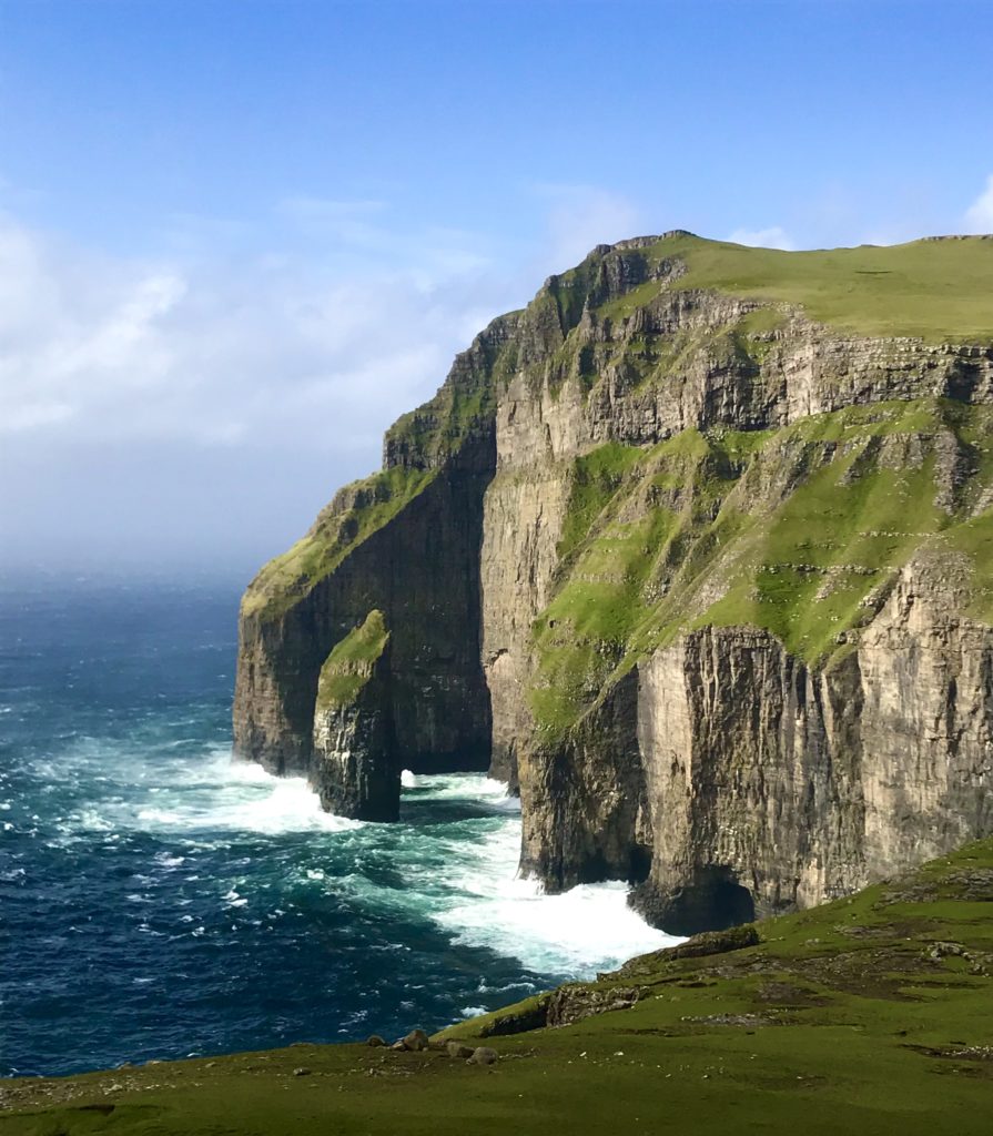
Having breakfasted with a group from Tórshaven, chatted with a fisherman and admired a farmer’s home-made whaling knife and pedigree chickens, we took time to observe the Saturday morning sheep herding before wandering south. Taking the old road rather than the tunnel to Sumba gave incredible views of the cliffs. Benisvørd is particularly loved and it’s easy to see why.
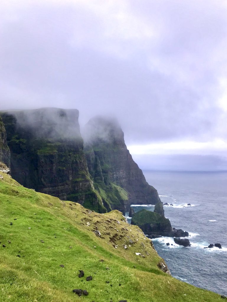
But that was the last we saw of cliffs that day because by the time we reached the pass at the top of the hills, the mist was rolling in and rain soon followed. We hiked through the clouds along the ridgeline towards the lighthouse. Along the way, we discovered Blæing, a huge boulder field full of Ice-Age tumbled shiny rocks of all shapes and sizes. We hid out in Cave Kasper used by sheep thieves (a terrible crime back in the day): a “cave” is a rather generous description for a hole created under one of the biggest boulders.
Back on the ridgeline, giant skuas dive-bombed us for walking too close to their nests; the oystercatchers were much more friendly. There is a viewing platform by the road overlooking the lighthouse in Akraberg. It smelt terrible and we soon discovered why. There were pieces of whale just over the side and the whole fencing was drenched in blood. It was like a sacrificial offering to the sea gods. We learnt from a kiwi-wielding local supply teacher that there had been a whale hunt a few days before and it was common to dispose of remains over the side of the cliff. Someone had got their aim a little wrong.
A damp camp, a quick photo-stop at the now-mist-free cliffs and a dash to the early morning ferry were the end of our Suduroy adventures. Worth it? Most certainly, if only for the friendliest people we met on the whole of the islands. There is a certain indifferent attitude to tourists throughout the Faroes. The islands aren’t trying to woo you with kitsch souvenir shops or olde-world dressed guides or even signposts. The waiters are not going to provide English menus or express any interest in your foreignness. They will just get on with their own lives. I can see why this may be interpreted as unfriendliness but there are many forms of politeness and one is minding one’s own business. We met some wonderful people and had great chats without constantly having to say where we were from or what we were doing. That suits me fine!
Southern Streymoy, Eysturoy and Vidoy
We detoured to Kirkjubøur for my one allotted dose of culture/history. The sun finally appeared: this is one of the sunniest places in the Faroes. The forlorn cathedral stands roofless overlooking the sea. The bay is known as St Brendan’s Bay after the Irish saint who is said to have voyaged to the Faroes and onwards to America in the 400s.
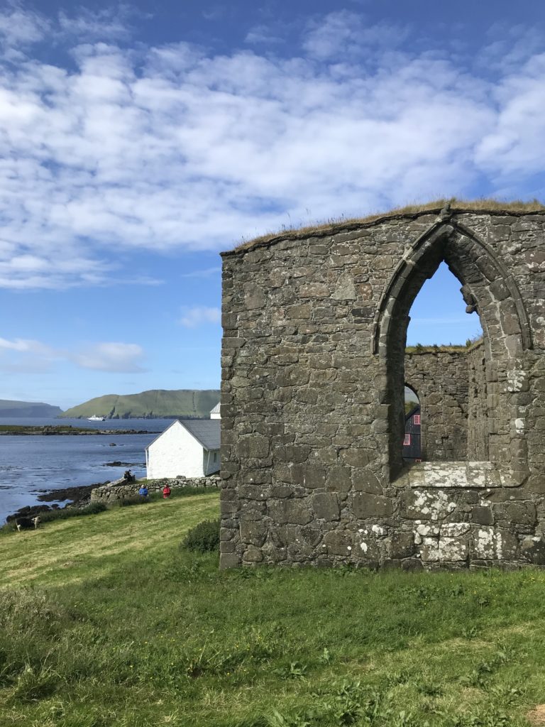
Kirkjubøur: St Magnus Cathedral 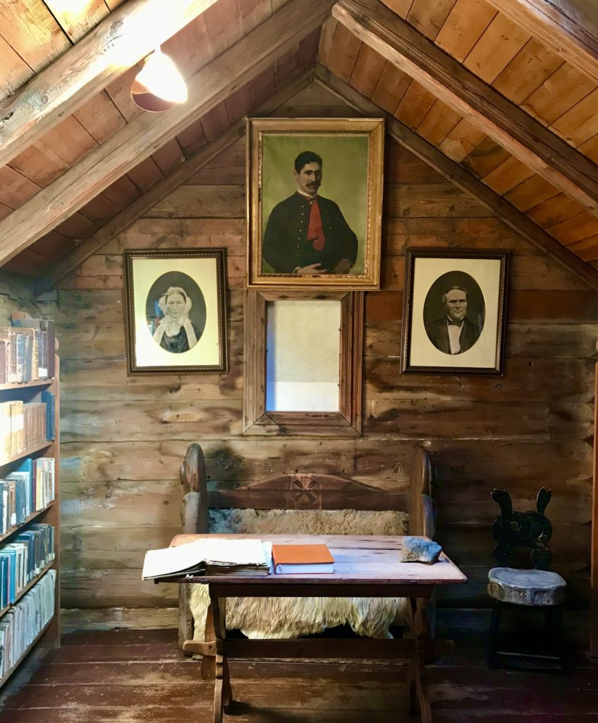
Bishop’s Study, Kirkjubøur
The next days were dedicated to hiking (in theory… with some driving sight-seeing as well!). Slættaratindur at 880m is the highest mountain on the islands. 48 minutes saw us to the top. It is cheating when the road takes you quite high before you need to hike! The mist was down but clearing to give us cheeky little views of Risin og Kellingin (Giant and the Witch) sea stacks and Fóssa waterfall. We followed the instructions in the guide to ascend the last part round the back of the mountain. The path takes you across below the summit then turns to the right after it. Some others tried to hike up the easternly side and got into a tricky situation by the cliff edge. Not a good idea.
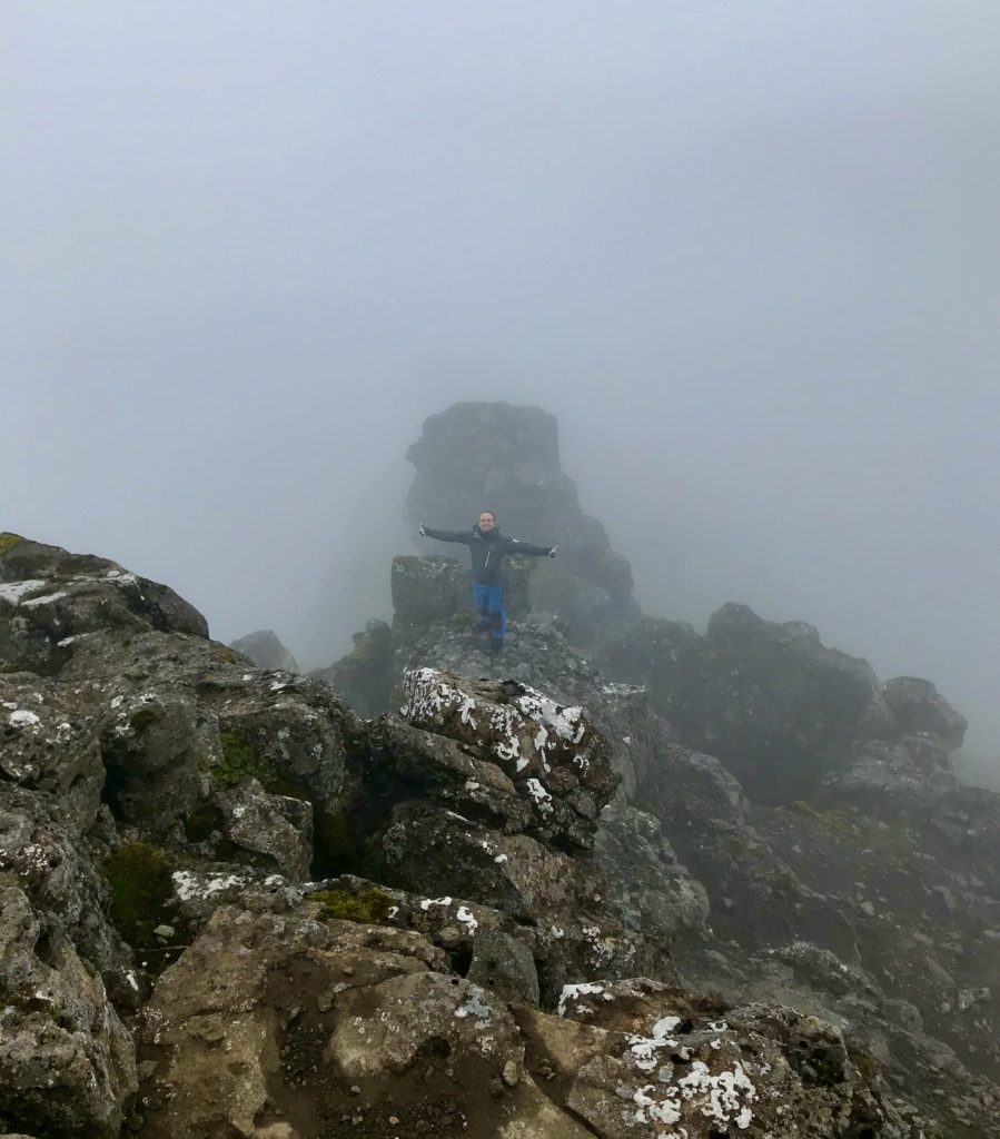
Don’t come up this way! Slættaratindur 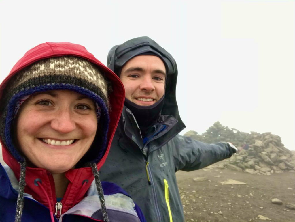
What a view! Slættaratindur summit 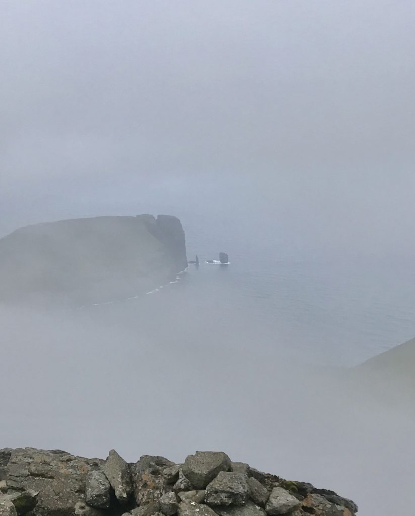
Risin og Kellingin (Giant and the Witch) in the mist 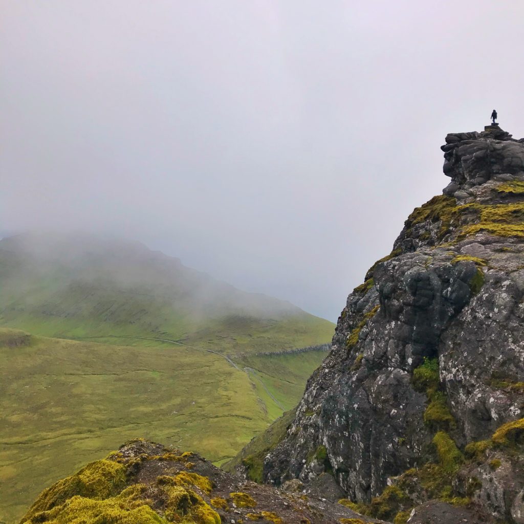
Slættaratindur ridgeline
We popped by Eidi to see the sea stacks from lower down (walking east of the campsite along the sea shore) before heading to the unpronouncable Gjogv to admire its gorge and perfectly placed red boat.
Eidi shoreline 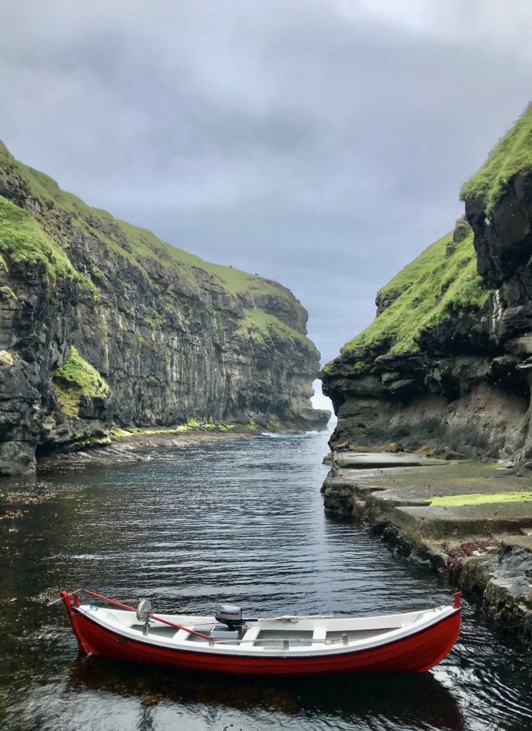
Gjogv village
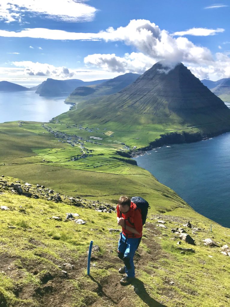
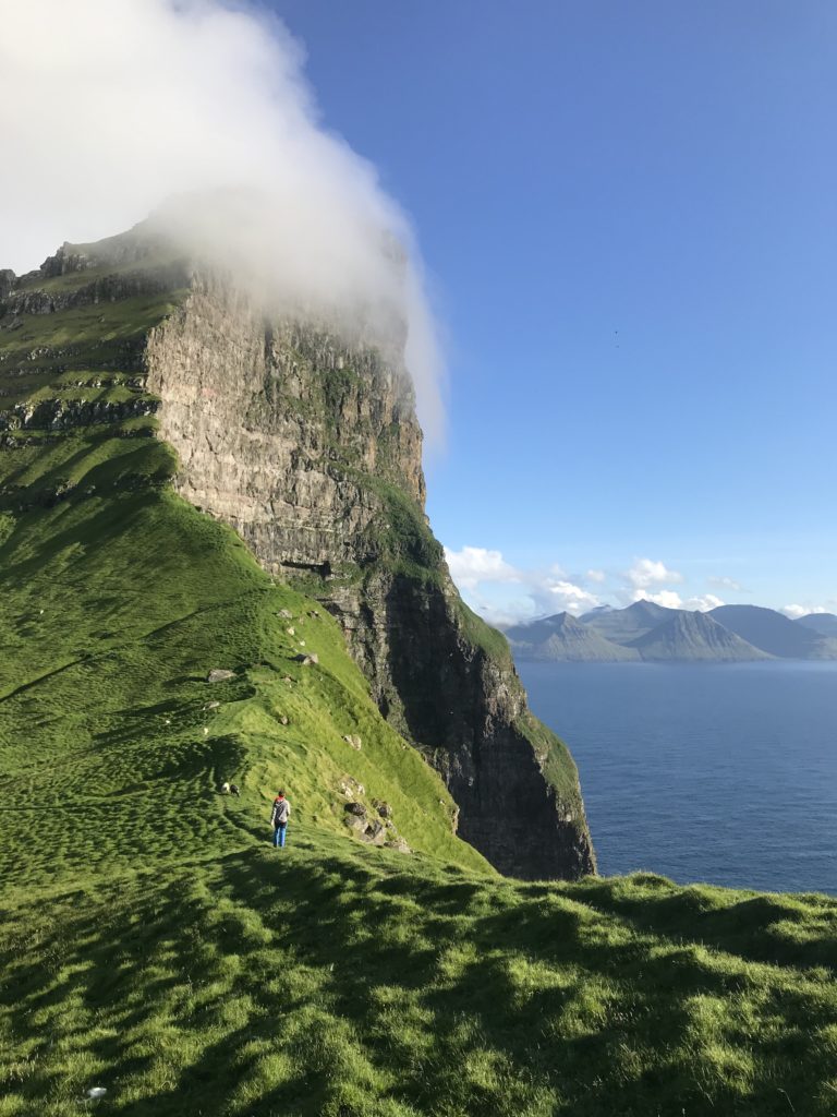
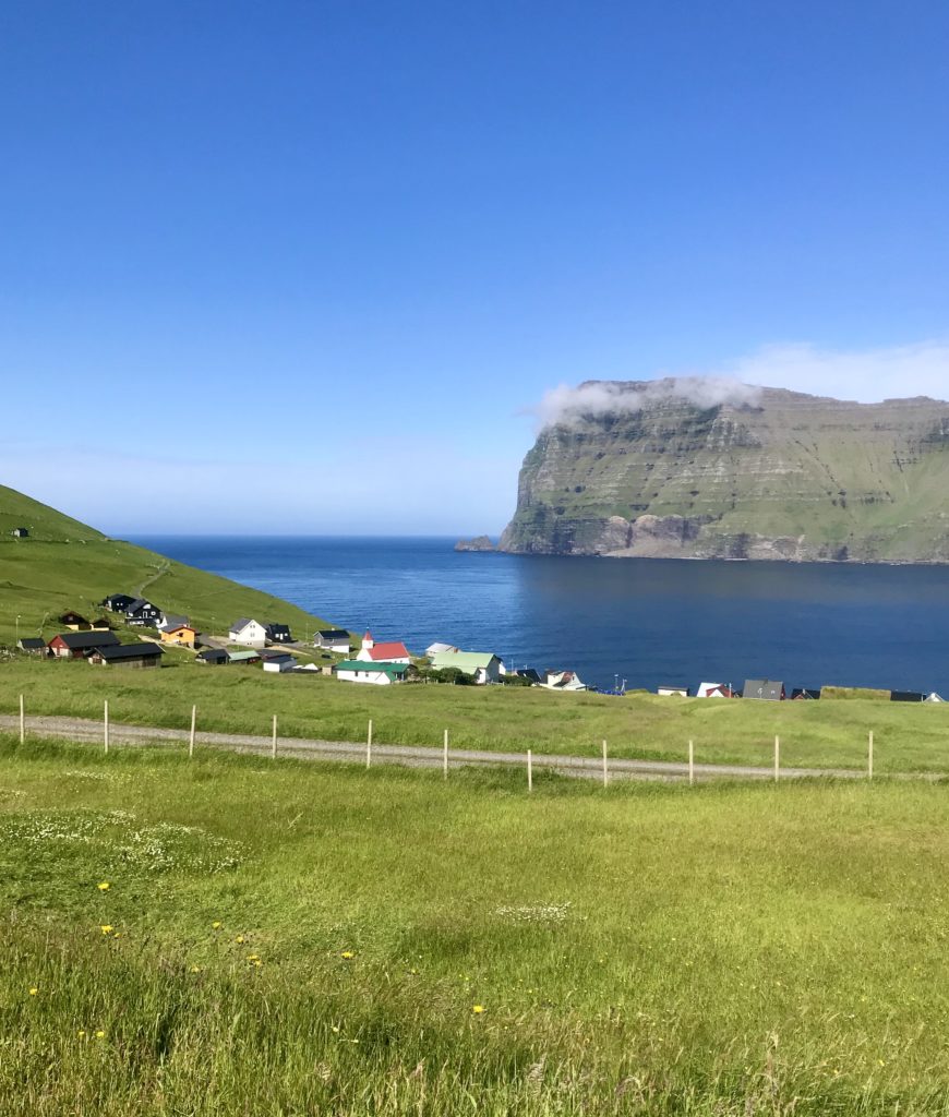
The next day was blazing sunshine and the clearest blue skies. We drove to Vidareidi on Vidoy, the most wonderfully situated village lying between two mountains, full of farmers cutting hay. The plan was to climb Villingadalsfjall and onwards to Cape Enniberg if possible. There is a fee for access, either 200 or 300DKK for us both that you put in an honesty box at the start of the trail (take the highest road until it stops at a carpark).
We set off through the bog discussing the merits of access fees. Given our path was clearly marked with blue poles, we could see where some of the fee money was being used for! The path simply goes straight up the mountain. It is loose rock and gravel which I could see being more treacherous when wet. On the way up, the mountains of all the surrounding islands appear. It’s hard to tell which mountain is on which island and suddenly these little islands seem quite a big world.
The last section before the summit is all larger loose rocks which I happily hopped through. There is a line of cairns leading off to the left before the summit. We popped up to the top before going back down to the cairns and following them towards Cape Enniberg. The scree seems to end abruptly at the edges at times leading to some discomfort in my mind. But we happily followed the ridgeline until there was an unpassable drop. George realised if we backtracked, the cairns actually led down to a path on the left-hand side of the ridge. I was a little nervous because it was narrow with an unknown drop. Thinking about the landslides, slippy grass and sudden weather changes I’d read about really didn’t help. But it was all fine, we crossed a short cabled section, a tiny scree slope and then back to relative flat to reach the true end. I lay down and peered down 700m over the edge, watching birds fly far below me.
On the way back, we met some Finnish ladies we’d seen on Slættaratindur the previous day. Despite being very competent in the mist the previous day, they had done as recommended and hired a local guide for this hike. Handily, I have a husband-mountain-guide. If you haven’t got one of those about and are a little nervous, it would be best to get a guide as recommended, especially if the weather is bad. We would never have found the right path in fog.
Hiking up Villingadalsfjall from Vidareidi 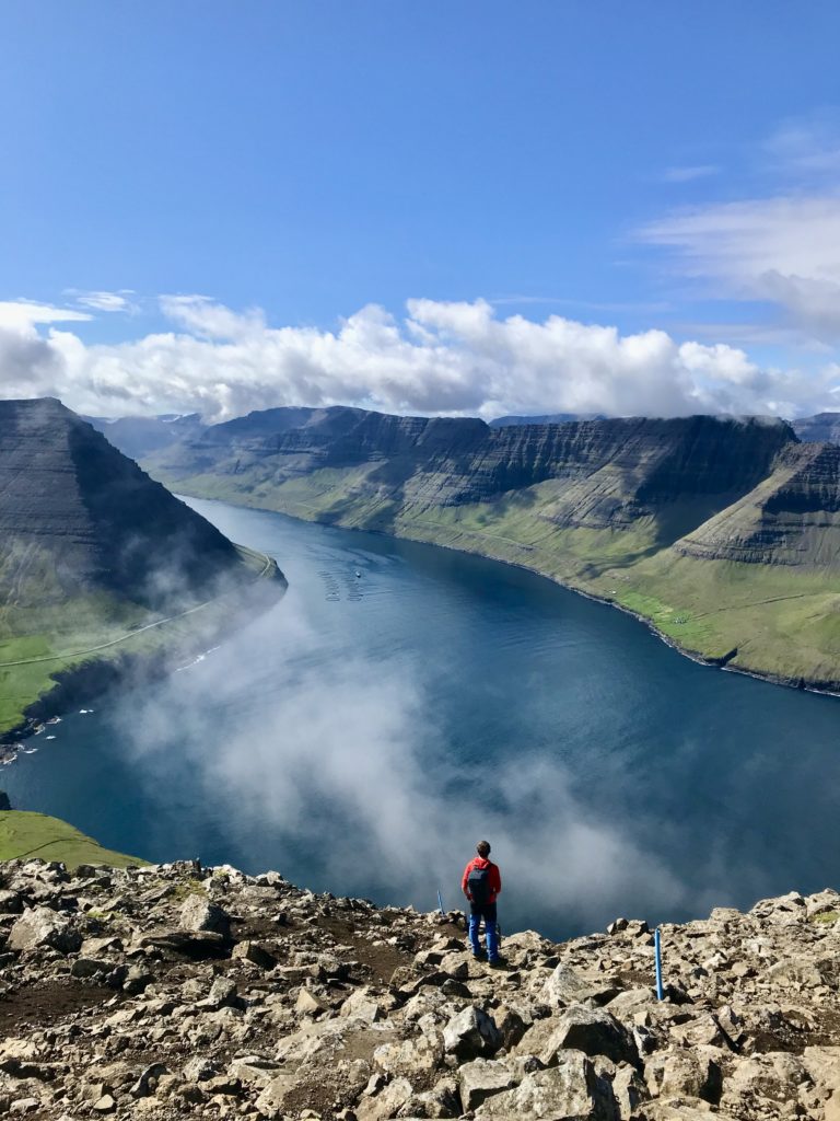
Looking over Vidoy and Bordoy islands Villingadalsfjall 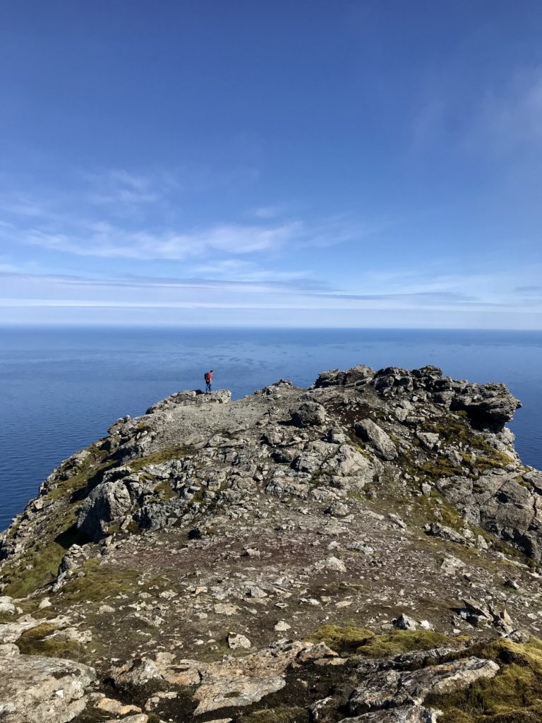
700m peering down 
Return from Cape Enniberg
Kalsoy
Fondly called the Recorder thanks to the multiple tunnels holed through it, we couldn’t miss this gem. It’s famous for Kellur lighthouse which is where lots of the iconic photos of the Faroes are taken. Kalsoy was some of the best scenery we saw and one of the more “tourist-friendly” places: there were information signs! And activities in Trøllenes! A shop even!
The ferry leaves from Klasvik and is a rather little thing whose jaws open at the front to receive your car. We arrived about 30 minutes before sailing and were lucky that the man in charge was a genius at packing in cars otherwise we would have been left on the pier. Sailing between the islands was a joy. When sea levels rise and the climate heats up even more, the Faroes will be the place to be.
Car packing on ferry to Kalsoy 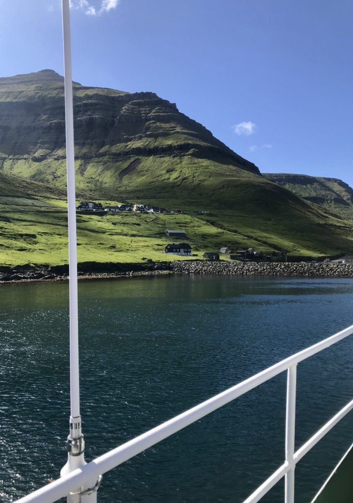
Arriving on Kalsoy
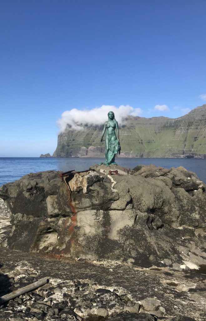
Disembarking the ferry, there was only one road north that everyone was driving along in a long convoy. God help the one car that had made the foolish choice to go the other way at this rush hour. The tunnels were some of the most fun yet. We decided not to follow the crowd and turned off into Mikladur to set up our camp and visit the Seal Woman statue. This statute fitted the description made by our guesthouse owner: “you see the mermaid in Copenhagen. She is nothing; she is tiny. Our Seal Lady is tall and big. Good strong Faroese woman”.
We chatted to a lady painting her house the ubiquitous red. She said that the house was hundreds of years old and contained the chest that had hidden the Seal Woman’s skin. We loved these tales and legends of the islands. Most stories told were not the stuff of epics impacting world history. They were local memories of pregnant milkmaids lifting stones or ways to explain natural phenomena like pirate ships becoming rocking stones. These were true stories of the people, not the names and coronation dates of kings.
Finally driving through the last tunnel to Trøllenes, we parked in the village/commune and wandered up the sheep track in the golden evening light. It was the perfect time to visit: no other people, bluebird skies, the greenest grass and the highest cliff behind the lighthouse.
View from Kellur Lighthouse, Kalsoy
It was great to be able to camp the night on the island, enjoying the evening and arriving in plenty of time for the ferry in the morning. We learnt from the trip over and arrived an hour early to make sure we would fit on the ferry. On the other side, we meandered through Klasvík which had a wonderful café and a place to buy postcards! All a bit of a rarity on these islands.
Northern Streymoy
I wanted to squeeze in some of well-known sites on the way to catch our pre-booked ferry to Mykines island (otherwise known as Puffin Paradise).
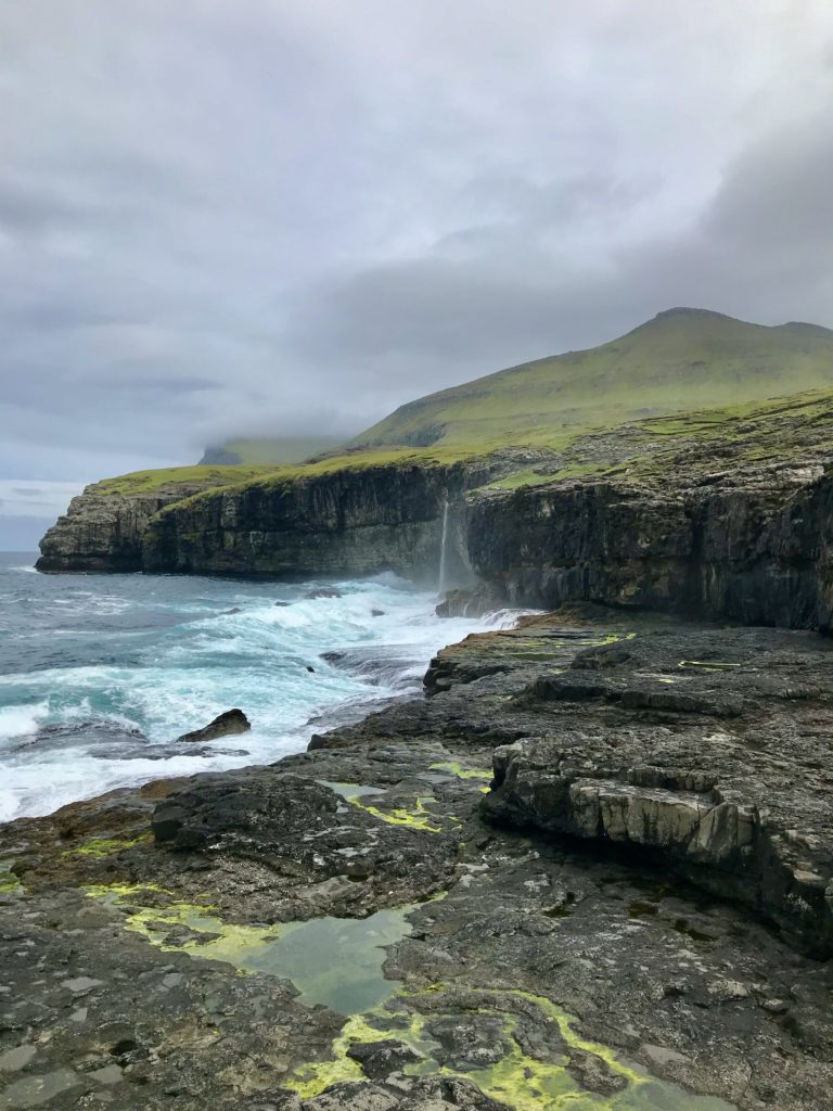
First was Fossá, the islands’ highest waterfall, situated south of Haldarsvík village. It falls a grand total of 140m. We followed the instructions on a handy information board and walked along a sheep track right of the falls. The track leads up a gully and back to the waterfalls so you can stand in the middle of the two largest sections. Of course there are bigger waterfalls in the world but this one is rather magical. I watched the spray dancing off the rocks, indadvertedly being turned into a model by George in my new Faroese sweater (found for a bargain at the Navia outlet store by Runavík).
The trail to the middle of Fossa Waterfall 
Fossá waterfall
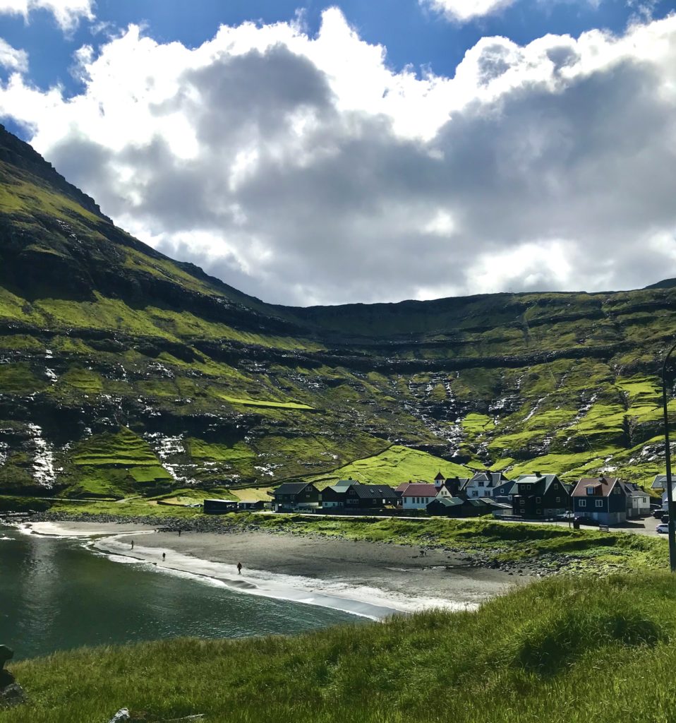
Next stop at the end of the road, the village Tjørnuvík. This was our favourite village on the islands. It’s perfectly situated in the bay, surrounded by potatoes fields and hay racks, mountains rising behind. George joined the local children digging on the beach while I examined the remains of old Viking burials and chatted to the man selling coffee and waffles at a picnic bench in the middle of the closely-packed turf-roofed houses. Out to sea, our old friends Risin og Kellingin stood tall and proud. I would have loved to hike over the hills to Saksun but we didn’t have time so had to settle for driving there instead.
Tjørnuvík village and beach 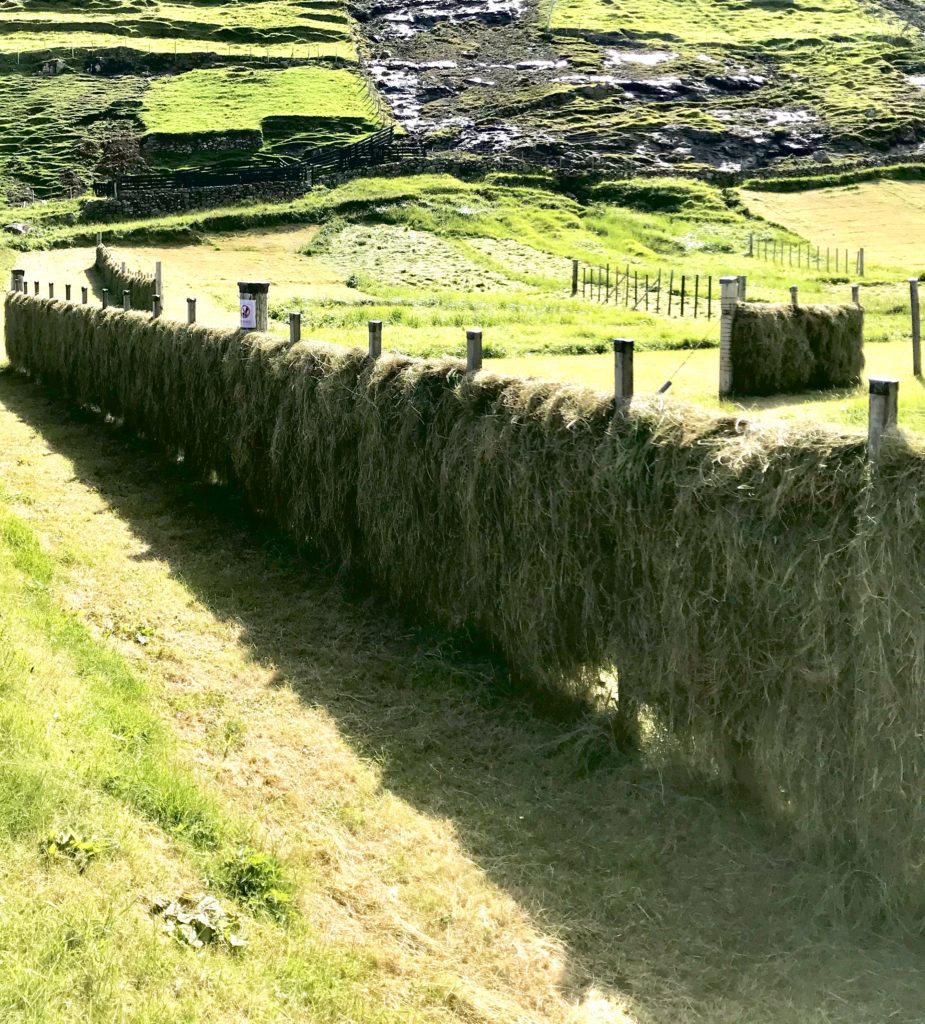
Hay drying, Tjørnuvík
Oh Saksun, known from so many Instagram shots! Maybe it was the weather turning grey, maybe we were over sight-seeing for the day, maybe there were too many people (about 20!!) but this village didn’t hit us as hard as you might believe from those curated shots. However, we did enjoy the drive there because the road reminded us of a road through a Scottish glen and it was one of the only inland roads we had driven!
Mykines
I had been put off going to Mykines by the fuss of pre-booking ferries, entrance fees, fear of getting stuck on the island, and so on. Also, I didn’t think I was bothered by puffins. How wrong I was.
I am very, very bothered by puffins.
It’s actually very simple: book the ferry or the helicopter. Bring some cash for camping or a coffee. Buy food supplies. Pack a small bag with what you need for staying overnight. Pray for good weather. Done.
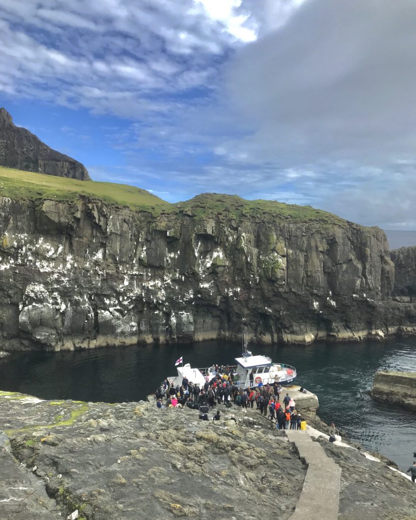
Our ferry was the last out that day and was loaded with supplies and what looked like a lads’ party from Tórshavn. The boat takes a slightly different route to and from the island, allowing you to admire Gasadalur village and Múlafossur waterfall on the way there and the rocky spine of uninhabited Tindhólmer island on the way back. Puffins dive into water as the boat passes. We passed the length of the island before being greeted by the whole village (or so it seemed) at the harbour. The couch, beers and bananas we were carrying were obviously eagerly awaited.
We walked up through the village to set up the tent by the stream. The start of the trail to puffins is on the harbour side of the village. I was mildly curious setting off. When I saw the first puffin burrows, I discovered that I were in fact the keenest ornithologist who ever lived. I stood in a cloud of flying puffins grinning like an idiot. Everything about those birds from their sad little faces to their waddling take-offs gave me joy. We also saw a huge colony of gannets, kittiwakes and a lighthouse… but the puffins!!
Arriving at Mykines 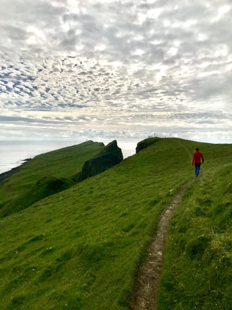
Walking to lighthouse, Mykines 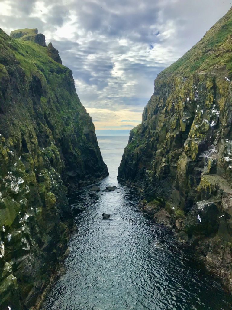
Cliffs Mykines 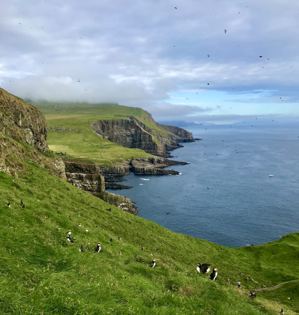
All those black spots are puffins! 
So many puffins…
The excitement of puffins so exhausted us that, back on Vágar, we skipped seeing Sørvágsvatn (the “optical illusion” lake) and huddled cosy out of the rain in Guesthouse Hugo in Sørvágur before a final dinner of salmon and a return to the bright lights of Copenhagen.
GENERAL ADVICE
Camping
It was worth taking the tent with us because we stayed in some amazing places and were able to see more without having to backtrack to a town to find somewhere to stay. When we were there, many places were not open or not open for foreign visitors, would only accept stays of one week minimum or were whole houses far too big for two people. So having a tent to fall back on was welcome.
However, there are only 21 approved campsites on the islands. You cannot wild-camp or camp wherever you wish. I’d marked all 21 roughly on a map which was very helpful. If possible, have a look at the campsite online before going! Some are on unused artificial football pitches and full of caravans: not what we were after (for example, Eidi).
People seemed terrified at the prospect of us camping but, honestly, it’s no worse than the UK. Just peg it out well for the wind and it’s fine… or maybe we were lucky?! Another thing to think about is that it will stay light in the summer so no need for a head-torch but bring a eye-mask if you struggle to sleep without darkness.
The best places we camped:
- Mykines: it says on the website to book this but I don’t think it would be a problem if you just turned up (we didn’t!). There is lots of space for tents on both sides on the village steam. Toilets are back down in the village. 100DKK per person paid to the lady running The Local cafe for a wonderful view over the village to the lighthouse.
- Mikladur on Kalsoy: a perfect location on the hill above the village by the football pitch (of course). Handy warm shower facilities used after a dip in the sea! They have a new method of paying online in advance which is useful.
Driving on the Faroe Islands
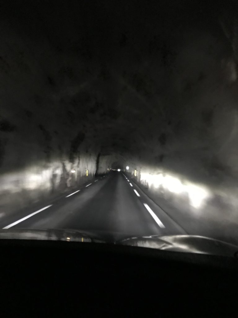
Be aware that you may not have encountered country roads like this before: single lane, a little bumpy at times, impatient local drivers. The Faroes have a fascination with tunnels. Some of these are nice and modern. Others are most certainly not: unlit, one-way, damp, rock-hewed snakes. Cars play chicken, driving at each other in the darkness before ducking into a passing place. A few of the car hire companies will warn you to take out damage cover because you will without a doubt damage your car. Luckily, I have a driver-husband whose favourite driving direction is reverse so it was all fine. We also buy a yearly insurance to cover excess on all our rentals because we rent a lot.
In these tunnels, one direction has priority. There will be a sign telling you which at the entrance of the tunnel. In some, the passing places are numbered and the numbers count down so that you know how many passing places are left.
On the positive side, don’t worry about getting lost! There’s not so many roads to choose from. You’ll find what you are looking for eventually.
Hiking
They need to work on some circular hiking routes. Most routes in the guidebook are old routes that linked villages in the past so they simply go from one destination to another. This is not helpful if you need to get back to a car or there’s not public transport both sides.
My old friend maps.me remained accurate and showed the paths well. Some (e.g. Tjørnuvík to Saksum, Villingadalsfjall|) were well-marked with signs and/or cairns. Others (e.g. Sumba ridge to Akraberg) require you to have a sense of direction. All were immensely fun and revealed spectacular sights. Remember to be respectful of the land and never walk on a field of precious grass.
Gastronomical Delights
Everyone has heard horror stories of the fermented or air-dried goodies that you will encounter in the Faroe Islands. In reality, good luck finding that cuisine. There is of course KOKS, the Michelin-starred restaurant where you will pay the best part of 300EUR. But that’s one evening.
Out of Tórshavn, options rapidly become severely limited. This is especially so if it is out of season, Sunday, or a day of bad weather. Places that advertise certain hours will almost certainly not be open when you really need them. Always have emergency supplies with you, get used to pizza and be prepared to rely on a sausage from a petrol station (well, is that really so bad a thing?! Yum yum).
The three best places we ate were:
- Muntra (Karvatoftir, Fuglafjørður on Eysturoy): apparently the oldest restaurant on the islands! Entry through the back door and up the stairs. Great salmon and steamed cod and lots of dill sauce while looking out at the harbour. Happy days.
- Frida Kaffihus (7 Nolsoyar Pals gota, Klaksvík on Bordoy): their set breakfast filled us right up after an early start. Eggs, cheese, meats, bread, musli… with coffee or tea. A lovely view from their balcony as well.
- Fiskastykkid (12 360 Úti á Bakka, Sandavágur on Vágar): another brunch/lunch place in the old fish-drying warehouse. The brunch is on a smaller scale but the fish soup was wonderful. They sell out of their famous rhubarb juice quickly and had to turn away people without bookings.
TOP TIPS
- Car hire is pricey but so is public transport so on balance, we thought the car was worth it. Just make sure you are comfortable driving single lane roads…
- Everything is expensive, for example almost 10EUR for a beer in a restaurant. I just had to get used to it and accept that that was the price of things. I did try and reduce costs by buying food from supermarkets for breakfasts and lunches but some things (like the ferries) cannot be avoided. This is not a budget backpacker destination.
- Expect the weather to be terrible, grey and wet at all times and then you might be pleasantly surprised! We were lucky and had some incredible days of sunshine. But what is good about the weather is that it changes quickly. I expected endlessly grey days like we get in Ireland where the clouds don’t move and the air is permanently damp. On the Faroes, it will rain and go dark but then that will pass and you may get sunshine!
- The islands are remarkably easy to hop between. I had marked the ferries on my map but really, this was over-preparation. I wish that we had taken a helicopter at some stage but there’s always the next visit!